Tag Archive for: ymir

Hall Siding Rock Guide Updates
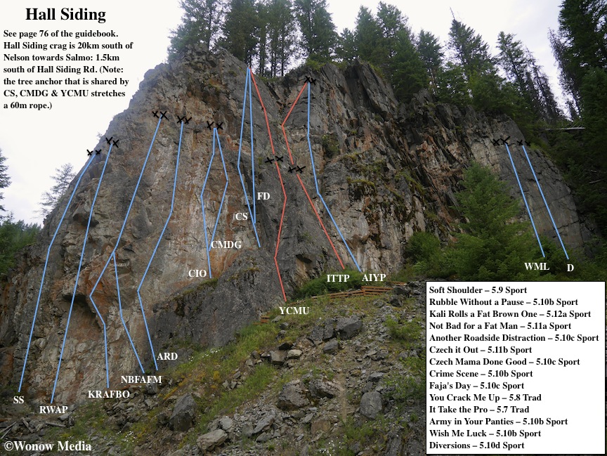
For further descriptions about the climbs at Hall Siding between Nelson and Salmo, British Columbia, refer to page 76 of the West Kootenay Rock Guide. Access: Hall Siding is located 20km south of Nelson towards Salmo. (Note: The WKRG erroneously stated the crag’s position in relation to Hall Siding Road – it is, in fact, 1.5km south of the road.)

Hall Siding Rock Guide Updates: This is the sixth in a regular series showcasing the new rock climbing routes in the West Kootenay Region of south-central British Columbia. For written descriptions of these and other routes, download the 2014 West Kootenay Rock Guide updates.

Ymir Swimming Hole Rock Guide Updates

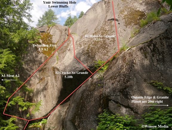
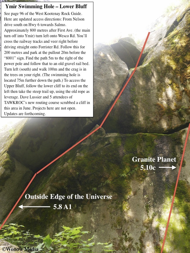
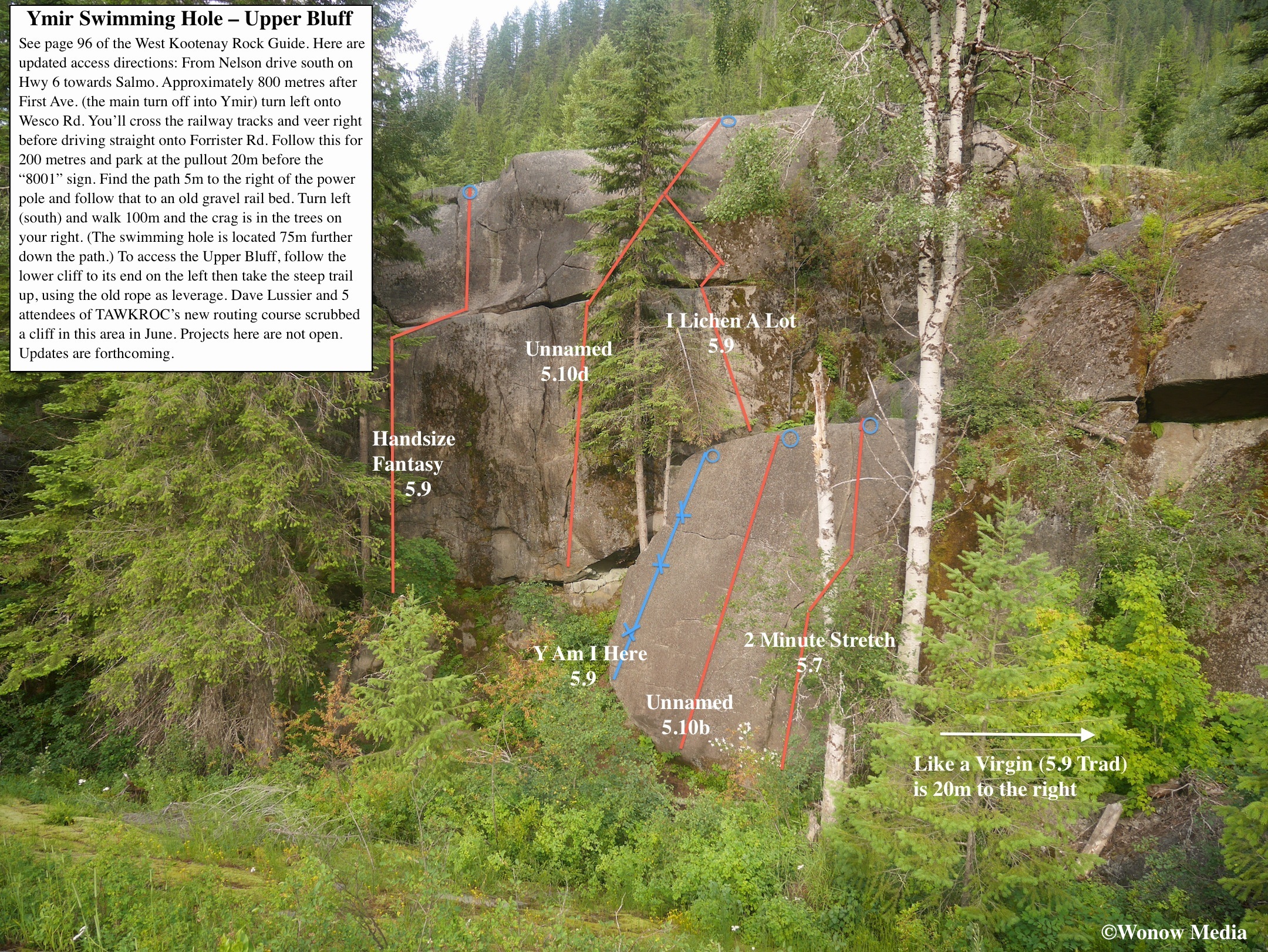
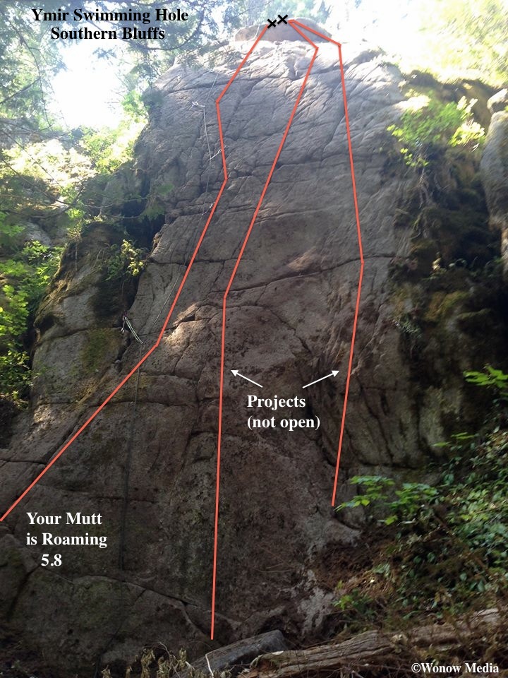
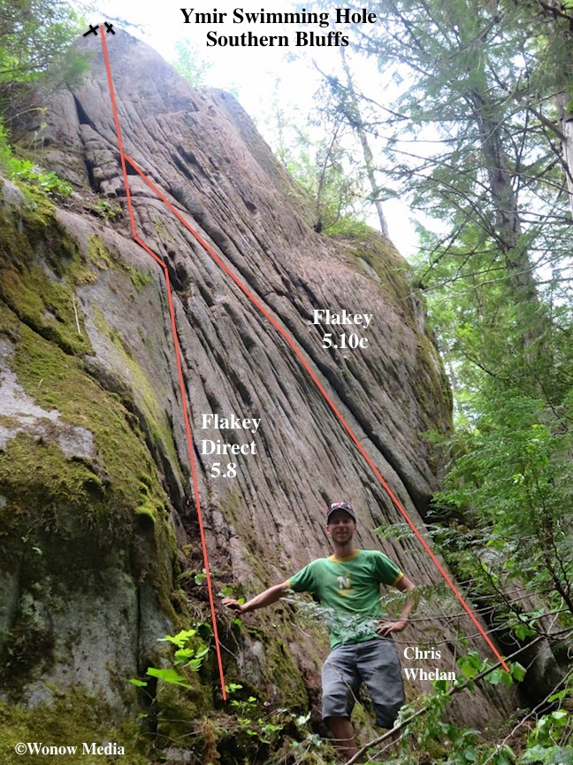
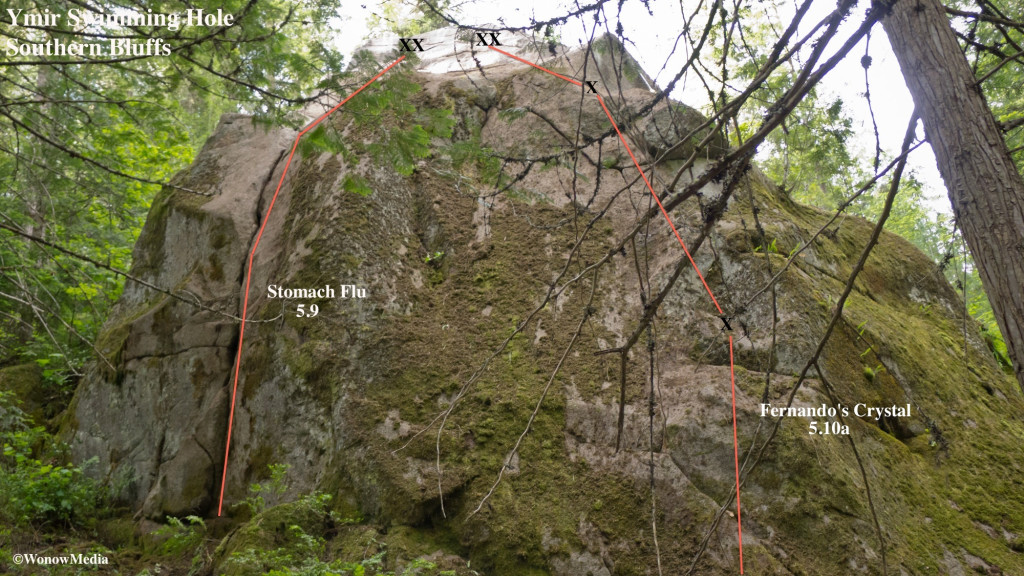
To reach Ymir Swimming Hole’s Southern Bluffs, continue past the Lower Bluffs on the path towards the swimming hole for about 30m. On the right take the faint trail (it’s opposite the path to the river.) There are a few small faces tucked in this area:

Ymir Swimming Hole: This is the fifth in a regular series showcasing the new rock climbing routes in the West Kootenay Region of south-central British Columbia. For written descriptions of these and other routes, download the West Kootenay Rock Guide updates.
Riverside Crag Rock Guide Updates

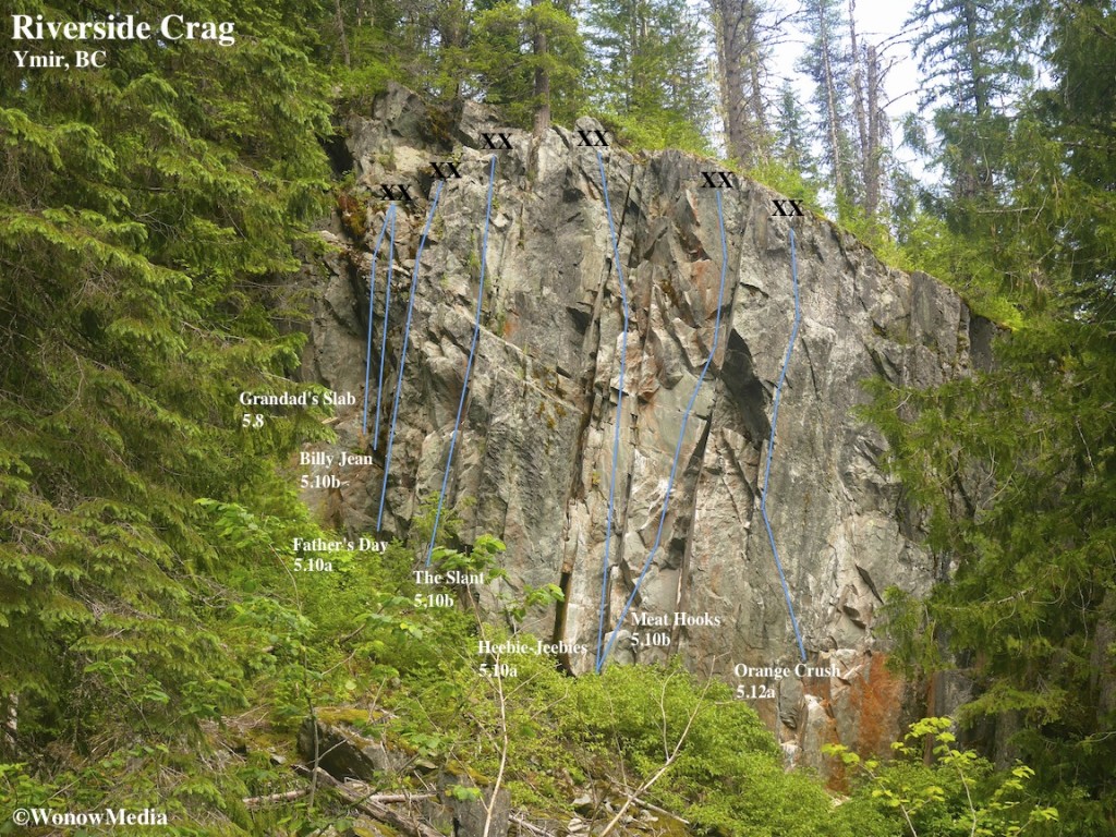
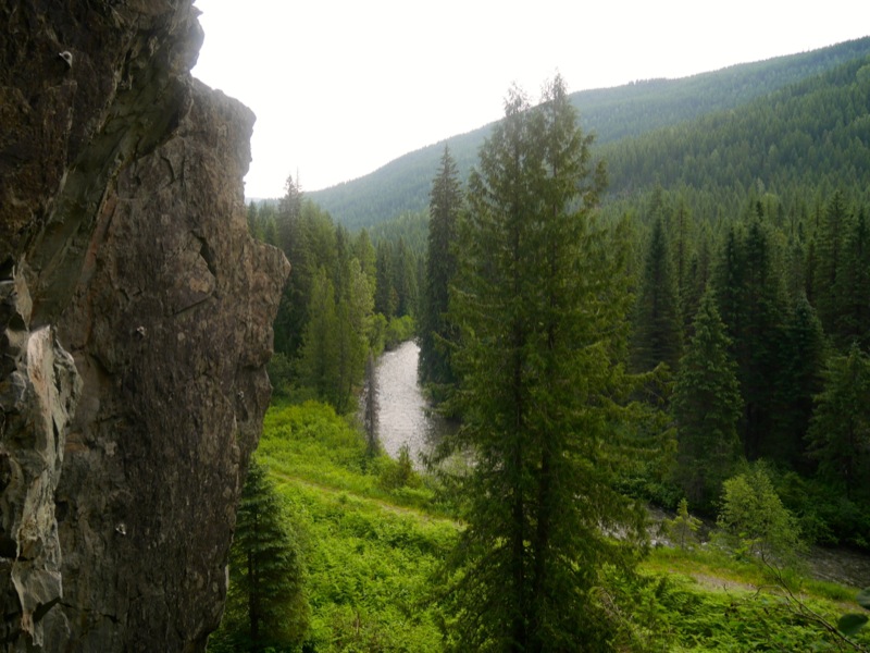
This east-facing crag boasts a great view of the Salmo River in a tranquil setting away from traffic. It is located in the woods across the highway from the Hall Siding climbing area. (See page 76 of the West Kootenay Rock Guide.) To access it, though, you must take an earlier turn-off. About 800 metres south of Hall Siding Road there is a dirt road by a Forest Fire Sign to your left. (If you’re approaching from Nelson, you’ll only see the back of the sign.) Turn onto this good-quality road and after 300m turn right at the fork and after 400m turn right again down a narrow track through the trees. In another 200m you’ll come to a grassy parking area. You’re now across the highway from the Hall Siding climbing area. Walk east into an opening in the forest and pick up a flagged trail that takes you to the old railroad line (it’s a five-minute walk). Turn right and walk 10m to see the 15-metre-high crag on your right. There is a short trail on the left to access the base of the routes. For detailed route descriptions please download the West Kootenay Rock Guide updates.

Riverside Crag Rock Guide Updates: This is the 14th in a regular series showcasing the new rock climbing routes in the West Kootenay Region of south-central British Columbia. For written descriptions of these and other routes, download the West Kootenay Rock Guide updates.
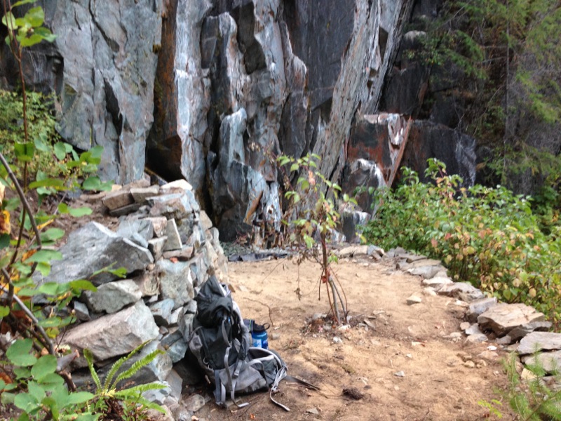
Breaking News: A good samaritan has done a lot of work at the base of Riverside Crag. They’ve built two retaining walls and flattened an area so it’s now a decent spot to bring your kids. There’s also a large flat stone at the base of Orange Crush now that a belayer can stand on comfortably.

2014 West Kootenay Rock Guide Updates

Wonow Media has announced the 2014 West Kootenay Rock Guide Updates are now available to download for free.

The updates include over 200 new sport, trad and alpine rock climbing routes from all over the West Kootenay region of South-Central British Columbia including Castlegar, Nelson, Slocan Valley, Arrow Lakes region and Ymir as well as beta on Grand Forks and Onion Creek in Washington State, just over the border from Rossland.

The free PDF download also includes a tick list of all 500+ routes in the region, from the 5.4 trad route “Exfoliation” at Kinnaird Bluffs to the 5.13 sport climb “A Delicate Push” at Kootenay Crag. What it does not include, however, is photo topo maps. Those will showcased in separate posts such as this one in the “rock updates” section of Wonow Media be available for retail in the coming months. If you have any corrections to these updates, please contact Vince Hempsall at: vince (at) wonowmedia.com. Click here to go to the page where you can download the free PDF.